|
|
|
|
|
|
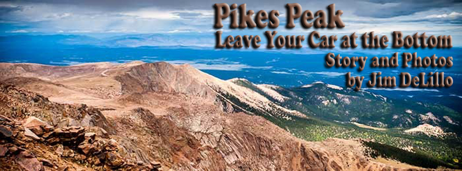
Sure, you can drive to the top and get a bumper sticker that reads "This Car Climbed Pikes Peak", but it's more rewarding to get the t-shirt proclaiming the feat done with your feet. Pikes Peak isn't a technical climb. You don't need mountaineering gear, ropes, or ice axes. This is a hike that can be accomplished by anyone in reasonable shape. Don't get me wrong; it's not a little ramble. The hike to the Pikes Peak Summit is just over twelve miles and 7,800 feet altitude gain, with most of the elevation gain over the first three miles of the trail. An overnight stay at Barr Camp at 10,000 feet elevation provides a welcome relief. The next day the climb continues to the summit at 14,110 feet.
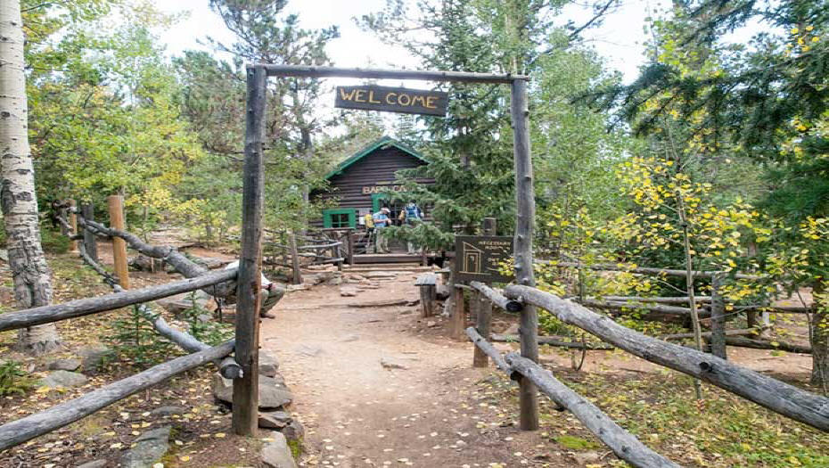
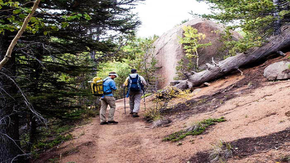
We wanted a sunrise start, but our guide insisted that 9 am would be fine. Unfortunately, by the time we did a pack shake-down, stopped to pick up some food for the trail, and parked our car it was pushing 11 am. The temperature was creeping up to 84 degrees by the time we got onto the trail. The first section of the Barr Trail is steep with a series of switchbacks. People passed us in both directions. Some in running attire, some just a bit faster than us... kids, teens, and families. The heat was already getting to me. The sun was amplified by the shape of the surrounding terrain, a parabola, focusing the rays back upon us. Heat is one of my personal complications on a hike like this. My 60-year-old body was dripping in sweat, my t-shirt soaked through. My blood was beginning to boil, not from solar radiation, but because of the late start caused by our guide. You don't need a guide. Barr Trail is well marked and well-travelled. Barr Camp is 6.5 miles from the trail head, about half-way up. There's a cabin where you can spend the night or camp in its shadow. We did the trip in two days, opting to spend the night at Barr. It was an evening that provided not only respite from the day's efforts, but home-cooked food – spaghetti and meat sauce, garlic bread, and cookies. It was a chance to talk to other hikers and get a feel for what our next day might bring.
The accommodations were spartan, just rows of thin mattresses on a long plywood platform. The mattress seams and our sleeping bags were all that separated us from literally rubbing elbows with each other. A small price to pay. The path up was a mosaic of rocks, dry hard pack, and the occasional mud wallow as we crossed some streams. A swath of pine needles cushioned our footfalls for a time as we traversed a pine forest. Stopping along the way we tried to get a glimpse of the summit. We were treated to a grand vista at Lightning Point where we could clearly see our goal. The next day we got our early start. I was up at 4 am and stepped outside. The air was calm. It smelled of balsam and campfire smoke. It was a clear night, the stars, however, were overpowered by the full moon casting shadows. We were too early for the prepared pancake breakfast, so we had to settle for some tea and a bowl of quick oatmeal.
Our packs were organized for the range of weather we might encounter. That time of year, October, we could have even gotten snow. Our kits included a hat, gloves, and a tri-climate jacket; it could have rained, in fact, stormed, but it looked unlikely as we set out under the indigo of predawn. We didn't carry tents, but we had bivvy sacks and sleeping bags. We weren't planning on spending the night but were prepared to do so. One of the killers on Pikes Peak is hypothermia. People start out on an 84-degree day like we did, dressed only in shorts, sneakers, and a t-shirt. The problem is, the weather changes abruptly. Wet clothes suck the heat right out of you. We left camp with the intention of reaching the summit before noon. The fall season is less likely to bring thunderstorms, but when they do come in, they crop up in the afternoon. Lightning strike is the number one killer on Pikes Peak. Lightning often hits hikers on the way down as they try to beat storms to the tree line. Our second half started out at relatively gentle, gradual grade. It got steeper and rockier as we made our way up the switchbacks to the A-Frame. This shelter was put in place by the US Forest Service. It was just a landmark for us, and we wouldn't be staying, but we could have used it in an emergency if the weather turned.
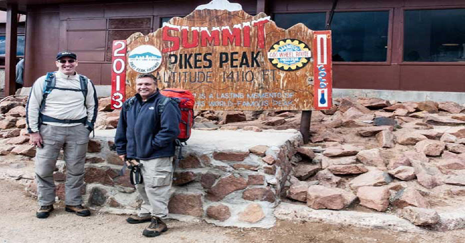
It seemed like forever to go the additional three miles. It was steep and rocky. The air was thin. I stopped frequently to catch my breath. Hikers above us outlined the switchbacks in endless zigzags. I groaned at the effort. My knees burned, my breath came with deep inspirations as I tried to extract the oxygen out of the ever-diminishing air. Soon a fifteen hundred foot drop over the edge focused my attention. Passing "The Cirque" the red rocks seemed imposing and the top even farther away than before. I struggled up the 16 Golden Stairs. I could see people at the top. They encouraged us to complete the top-out, and we were greeted by the gift shop. We posed for the obligatory photo next to the Summit Sign.
"Two tickets, please." The Cog Railway got us back to our car, which we had left at the bottom.
If You Go
Where to Park Don't park in the Cog Railway parking lot. Go past the Cog parking lot, take a right on Hydro Street and a small, pay lot is at the top. If that lot is full, go back and locate a legal parking spot along Ruxton Avenue and walk back to the trailhead, which is adjacent to the parking lot. You can also choose to park in a paid parking lot in Manitou Springs and take the free shuttle to the base of Barr Trail. What to Bring
What to expect
Altitude Diamox - Acetazolamide is used to prevent and reduce the symptoms of altitude sickness. It should be taken two days before you start the hike and you should continue taking it during the hike. One side effect is that it acts as a diuretic, increasing the frequency of urination; hence the need to drink plenty of water.
Heat
Hydration
Pack Weight Other Information
•
Important Cog Railway Information -
If you plan to use the train as part of your
journey. Knowledge of the trail and safe hiking on it comes from my personal experience on the Barr Trail.
Prints of Jim DeLillo's photos used in this
article, and more, are available at:
Author's Bio Jim has recently added Milky Way photography to his skill set.
His portfolio can be seen at: |
Connect with us on:
American Roads and
| ||||||||||||||
|
Public Disclosure--
Please Read I recently learned of a FTC law requiring web sites to let their readers know if any of the stories are "sponsored" or compensated. American Roads and Global Highways' feature writers are professional travel writers. As such we are frequently invited on press trips, also called fam trips. Most of the articles here are results of these trips. On these trips most of our lodging, dining, admissions fees and often plane fare are covered by the city or firm hosting the trip. It is an opportunity to visit places we might not otherwise be able to visit and bring you a great story. However, no one tells us what to write about those places. All opinions are 100% those of the author of that feature column. |
|||||||||||||||
|
Privacy Policy/ Archives /
Contributors /
Subscribe to
American Roads Books by
Kathleen Walls /
Contact /
Sponsor or Advertise/ American Roads & Global Highways Home Page
|