
If
you missed the first part of Mesa Verde Country:
On the Trail of the Ancients:
Part 1
click here to see it.Summer 2016 issue, Native Trails
Ancestral Puebloans didn't
limit themselves to Mesa Verde National Park. They
built dwellings throughout the four corners area. We
were trying to see allof the most interesting ones
so we headed for Canyon of the Ancients National
Monument. It was created to protect these sites. Our
guide, Jim Colleran told us to "look for sage and
prickly pear cactuses growing on rubble mounds" to
recognize unexcavated sites.
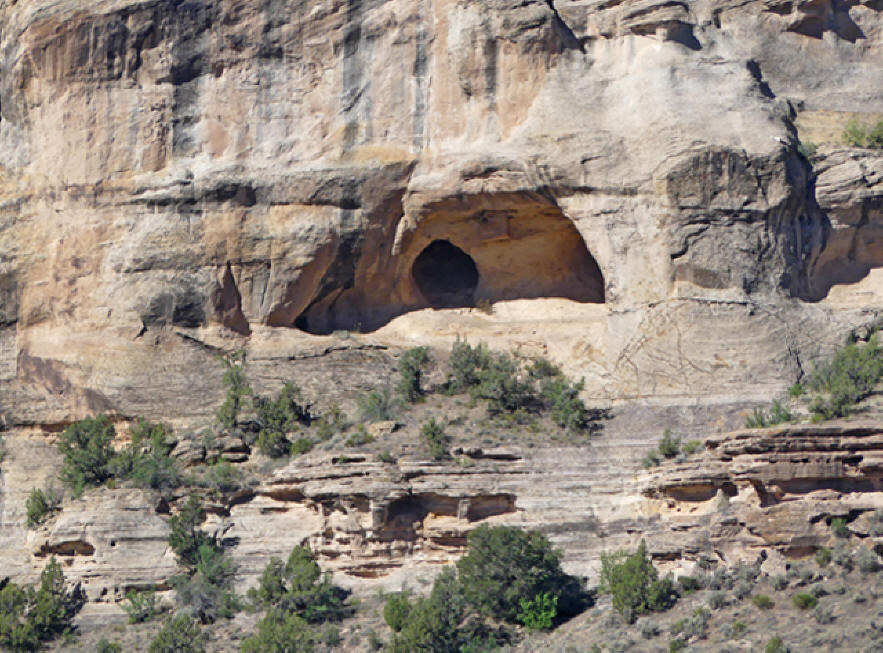 |
| Probable ruins site
near Castle Rock |
We drove to Castle Rock in the
Sand Canyon area of Canyon of the Ancients. Castle
Rock was once called Battle Rock but in the 1800s,
the names were switched by a survey team. Now Battle
Rock is the one to the southwest.
There's a
flat place on top of the rock formation. This was
where a group of Ancestral Puebloans build their
city in the latter part of the 1200s. An ancient
legend and anthropological evidence indicate these
people were being harassed by a group of nomadic
tribes, probably ancestors of modern Utes.
These
invaders may have originally come to hunt or trade
with the local people, liked what they saw and
permanently moved here.
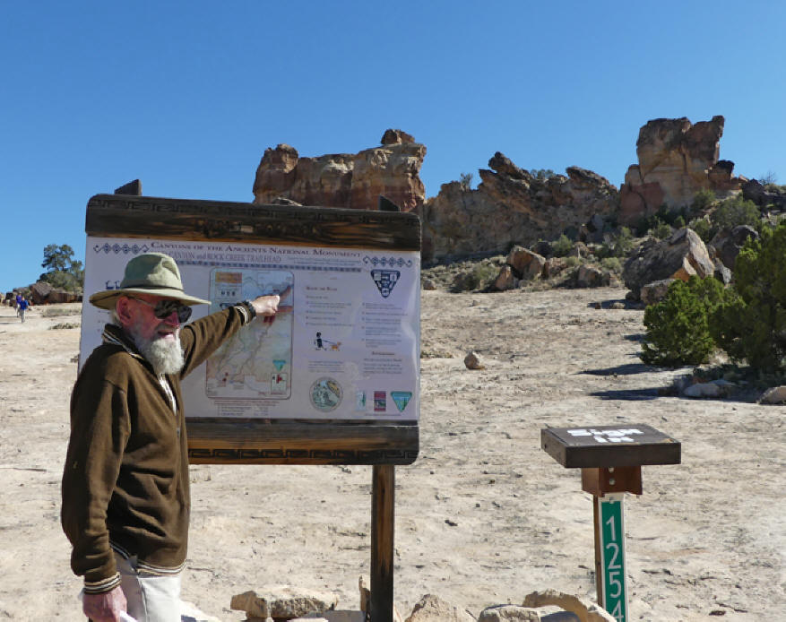 |
| Jim Colleran points
out features of Castle Rock |
I couldn't resist making my way
partway up the slope to examine the site closer.
Naturally, in spite of advice from our guide, Jim, I
wore my usual earth-shoes sandals instead of those
sensible but so confining tennis shoes. I made it
pretty easily. Once Jim told us the boulders in
front were once part of a wall built around 1250 as
a territorial marker and for defense, it was obvious
where they have been shimmed to fit in place. In
spite of the high place and walls, invaders must
have breached the site and defeated the locals,
killing many of them. Anthropologists found many
skeletons left in the kivas. Wounds and the
placement of bodies indicated a battle after which
the Ancestral Puebloans left.
Respect the ruins. This is the trailhead for
a nice hike with plenty of ruins.
Remember if you visit, do not disturb any
sites or take any artifacts.
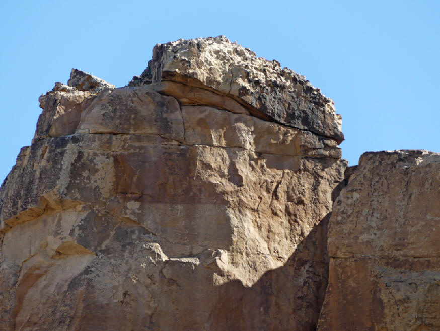 |
| Castle Rock with
flat area on top where Ancestral Puebloans
built |
About a half-mile before we
reached the Utah border there's something worth
pulling over for, a big rock formation almost on the
highway. On the inner side of the rock, there are
ancient petroglyphs made by the Ancestral Puebloans.
Some modern graffiti was scribbled on the rock at
some places also.
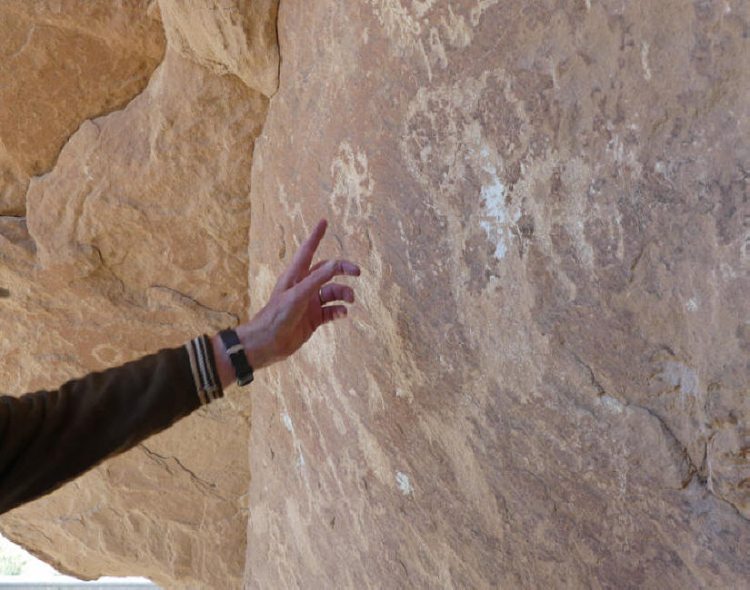 |
| Jim points out
Kokopelli, a humpbacked flute player who was
the god of fertility. |
Our next stop was a quarter
mile down the road.
We took the road to the right. The pavement
ended but the dirt road was drivable. Our fearless
driver, Christy, took us into Yellow Jacket Canyon.
And Jim showed us a rock filled with petroglyphs.
This one was more of a challenge for the sandals but
I still clamored up the rocks and was rewarded with
a great view of the petroglyphs. This one much more
pristine.
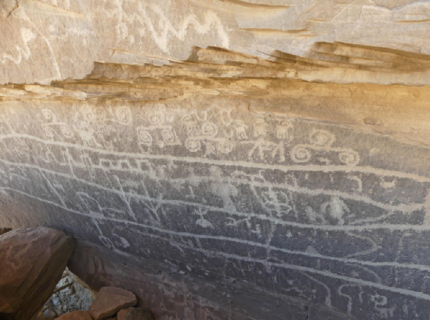 |
| Since these
petroglyph are harder to access so
completely pristine. |
We passed in front of the old
Ismay Trading Post. It's closed down now but was a
local hotspot since 1921 when it was opened by John
and Eleanor Heffernen Ismay. Not too long ago the
road into Cortez was so difficult that workers would
shop here instead. There's a huge bin of glass
bottles in front. It was filled by workers who would
stop, buy a six-pack, pop open a bottle, finish, and
toss it on the heap before driving home.
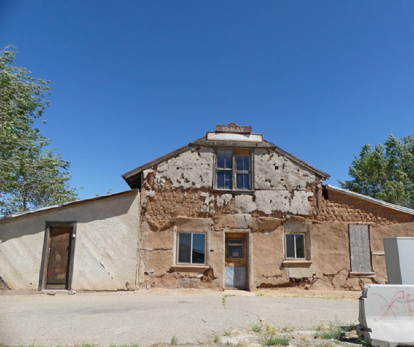 |
| The old Ismay
Trading Post an icon of its day |
Wildlife is common in this
area. Look for mule deer and a colorful little
lizard called eastern collared lizard.
The one I saw was scrambling among the rocks
in midday. Deer are more common at sunset or early
morning. I saw one grazing the evening before. The
cliff swallows make nests on the overhang of exposed
rock. This is the trailhead for a nice hike with
plenty of ruins.
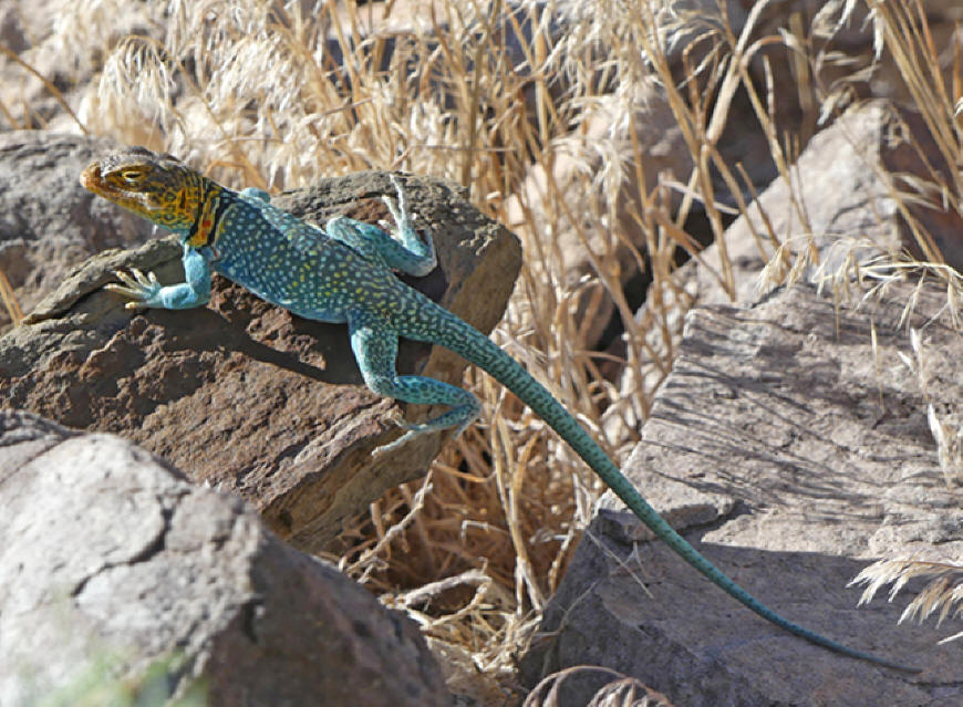 |
| Eastern Collared
Lizard |
Perhaps the most famous site in
Canyon of the Ancients is Lowry Pueblo, noted for
its Great House and Great Kiva. Lowry Pueblo is
unique in several ways. It was built on top of an
earlier pit house settlement and shows strong Chaco
Canyon, New Mexico influences in the construction.
It was a large community scattered around the site I
probably was home to as many as 100 people.
 |
| Lowry Pueblo has
good signage |
The Great House was multi
leveled and well laid out with about 40 rooms and
several kivas. The rooms are larger than most of the
other sites you have visited. There are decorative
items such as small chinked in stones that is
typical of the Chaco Canyon pueblos. We descended
into one of these original kivas though a narrow
passageway. It is preserved much as it would have
been originally. When we entered it felt as if we
had stepped back in time. In this kiva, you can
observe the upper walls which has shelves built in
probably to hold ceremonial items. So much more of a
reality feeling here.
 |
| Jim explains
features in a room of the Great House at
Lowry Pueblo |
We walked over to view Great
Kiva. It is far larger than most kivas and probably
used for community events. The stonework pieces in
the center are believed to represent the summer
people and the winter people. Each group was in
charge of the rituals during their season.
 |
| The Great Kiva |
All around the site there
are walls
and smaller pueblo ruins and it's not unusual to see
bits of pottery on the ground. Remember not to
remove any. There are restrooms and a picnic area.
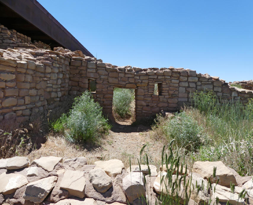 |
| Portion of a pueblo
at Lowry Pueblo |
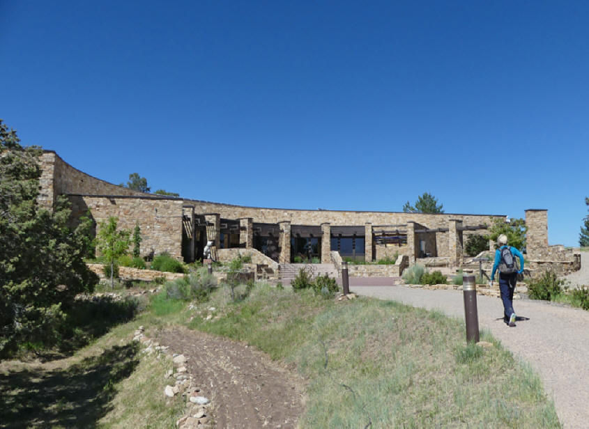
Anasazi Heritage Museum is 10
miles north of Cortez
is the
visitor's center for Canyon of the Ancients You'll
find over 3,000,000 artifacts that were excavated in
the area. There is a theater and a library and is as
much for scholars as casual tourists. To the rear
there is a one-mile trail that leads
to Escalante
Pueblo.
 |
| Anasazi Heritage
Center |
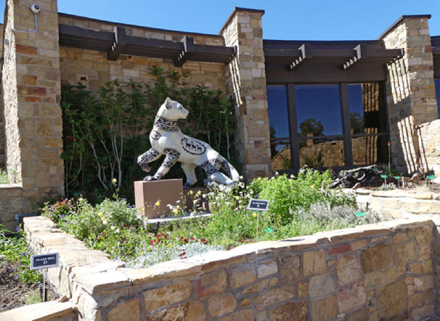
A black and white life sized
puma stands guard in one of the Center's garden
beds. It's one of 17 public art projects of the San
Juan Mountains Association called Pumas on Parade.
This guy's name is Chuska Puma and his black and
white pattern is
reminiscent of Ancestral Puebloans' pottery.
If you get to the visitor's center in Cortez,
you'll see another one named Sky Prowler. It's sky
blue and covered with clouds, stars and rainbows.
 |
| Chuska Puma at
Anasazi Heritage Center |
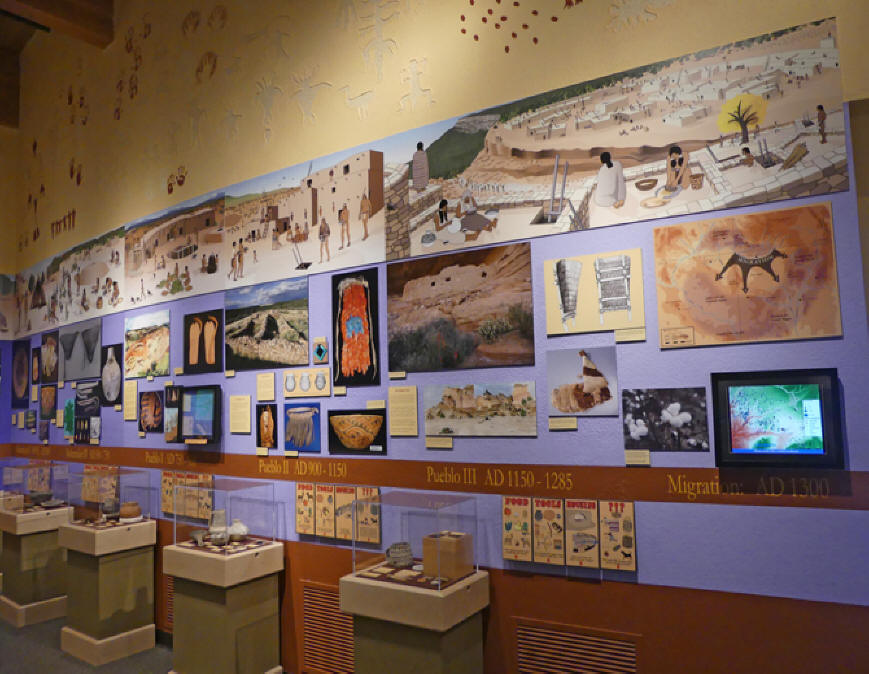
This museum tied it all
together for me. The ruins tell the story of
greatest transition humankind made in this country.
From the earliest pit house, when people moved from
hunting and gathering to agriculture and for the
first time gathering in villages. The timeline
running on the wall helps put the ruins into
prospective.
 |
| Timeline wall |
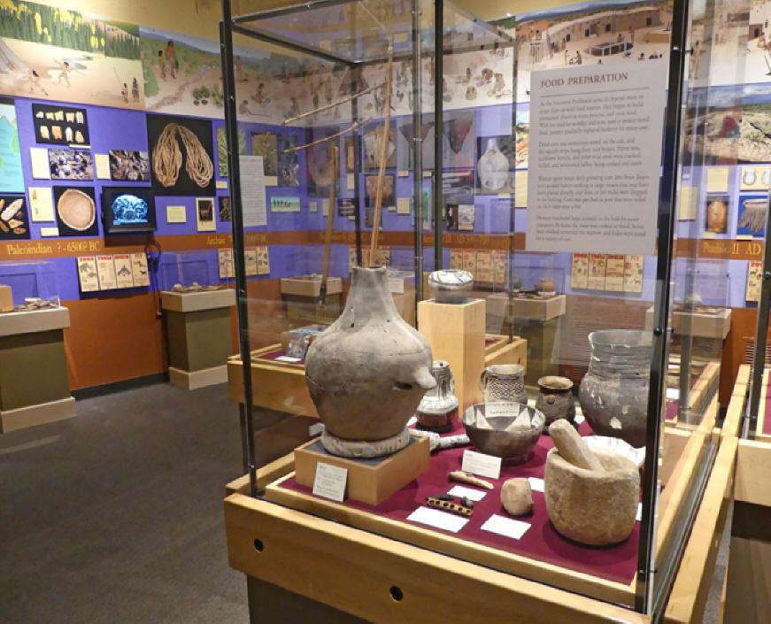
Think of it as tecnological
advances because this was the high tech of the day.
Normally cooking was a tedious process of dropped
hot stones from a firepit into the food set in
waterproof baskets to cook. One exhibit shows the
pottery these people invented. Pottery, especially
fireproof pieces, was a huge technological advance.
Now they could cook beans in pottery directly over a
fire. Bean cooking would have been impossible with
the dropping the hot stone in baskets method.
 |
| Food preperation
utensils |
This led to another advance in
weaponry. Their arsenal advanced from the old
atlatl, a spear thrower that increased leverage
making it a more powerful weapon than just a simple
spear, to the bow and arrow. Since they now were
able to get some of their protein from beans they
could survive on hunting smaller animals such as
rabbits and deer. Exhibits in the Center trace all
of this.
 |
| Tools and weapons |
Incidentally if youplan to
visit with children, they're not likely to become
bored The center has many interactive exhibits that
appeal to children.
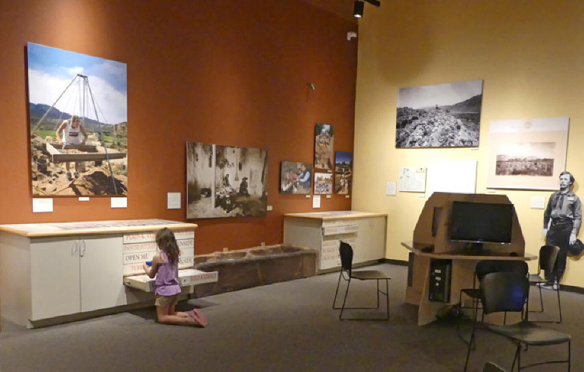 |
| Definitely kid
friendly |
My favorite exhibits relate to
the pit house. These multilevel exhibits let you
view from above then walk to the lower level and get
a different prospective. The upper lever has a
detailed diagram showing construction details.
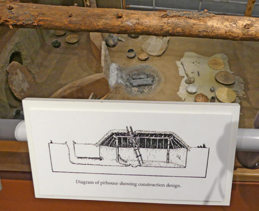 |
| Pit house exhibit
from above |
From the lower level, you see
many of the items used in the day to day lives of
these people.
I was able to understand the firepit and
ventilation system seeing it here rathere than when
I sar parts in actual ruins.
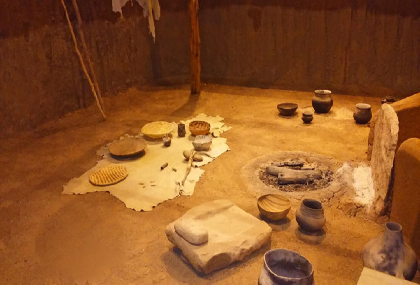 |
| Lower level view of
pit house |
Much of the artifacts in the
Center came from the Dolores Archaeological Program.
That program came about between 1978 and1986, when
it was decide to build a dam nearby. Before the
McPhee Dam Reservoir could be built scientist wanted
to preserve any relics in what would become the
Reservoir's bottom. This was the largest public
archaeology project ever undertaken in the United
States. The excavation discovered 1600 prehistoric
households and villages in the Dolores River Valley.
One exhibit tells a little of this project.
 |
| The Dolores
Archeological Project exhibit |
Another exhibit relates to the
huge trading base these people had. It ranged as far
away as Mexico and Central America. Pottery was a
big trading item as they made very beautiful pieces.
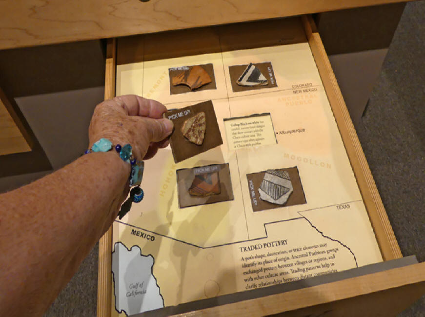 |
| Sample of
different kinds of pottery in trading
exhibit |
Another exhibit that helped me
visualizes their lifestyle was replicas of rabbit
skin and a turkey feather blankets.
Although they kept turkeys and dogs, there is
no evidence either were eaten. Turkeys would have
eaten garden pests and their feathers were used for
robes and blankets. There wer two tyopes of dogs
found one large and another smaller black and white
breed. I have no idea how anthropologists knew the
dogs were black and white but they seem to know
that. Dogs were pets and probably watchdogs.
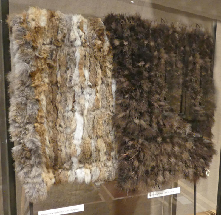 |
| Exhibit of rabbit
skin and turkey feather blankets |
McPhee Dam Reservoir, the
original repository from which so many of the
Center's artifacts came, is just 10 minute drive
north of the center just behind Escalante Pueblo. It
offers boating, water skiing, fishing, hiking and a
campground.
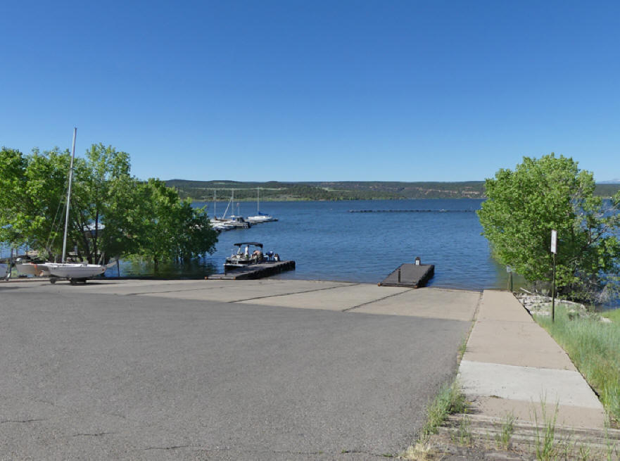 |
| McPhee Dam Reservoir |
I had never heard of Hovenweep
National Monument before this trip but it is another
must see. It's just across the Utah border in Navajo
Territory. One of its most spectacular ruins,
Cajon Ruins
in the heart of Navajo Country, is a bit off the
beaten trail but trust me. Go find it. One of the
pueblos perches on the edge of a cliff.
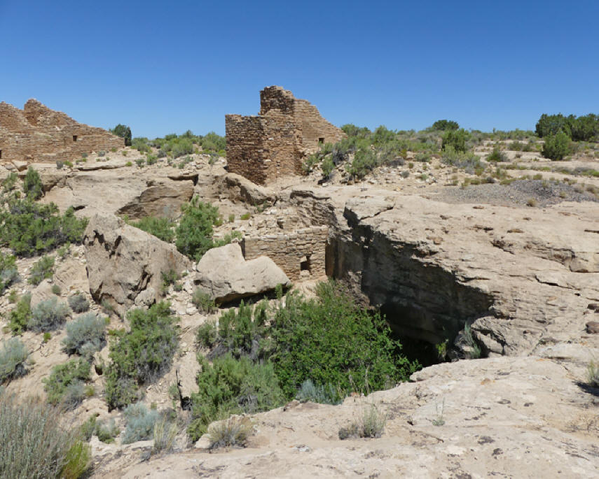 |
| Cajon
Ruins |
On the rear wall, you'll see
several oddly placed small holes. These holes
admitted shafts of sunlight that marked a specific
spot on the interior wall at summer solstice. These
people farmed under the harshest conditions, they
needed to plant before the summer solstice to take
advantage of seasonal monsoons. That they tracked
the dates, suggests a solar calendar. One nice thing
here is there are no rangers to hurry you along. You
can wander around to your heart's content.
 |
| Are these solar data
recorders? |
Hovenweep Visitor's Center,
several miles away, has shelters with tables out
front. Inside there are exhibits of Ancestral
Puebloans artifacts. There is an interpretive film
and rangers conduct programs on a regular basis. We
headed part way down the two mile hiking trail from
the visitor's center to the Square Tower Group which
is the largest collection of Ancestral Puebloan
structures at Hovenweep. It was named for the
four-story tower sitting at the head of the canyon.
Stronghold House was the first structure that caught
my eye. It's is named for its fortress like
appearance rather than any known purpose.
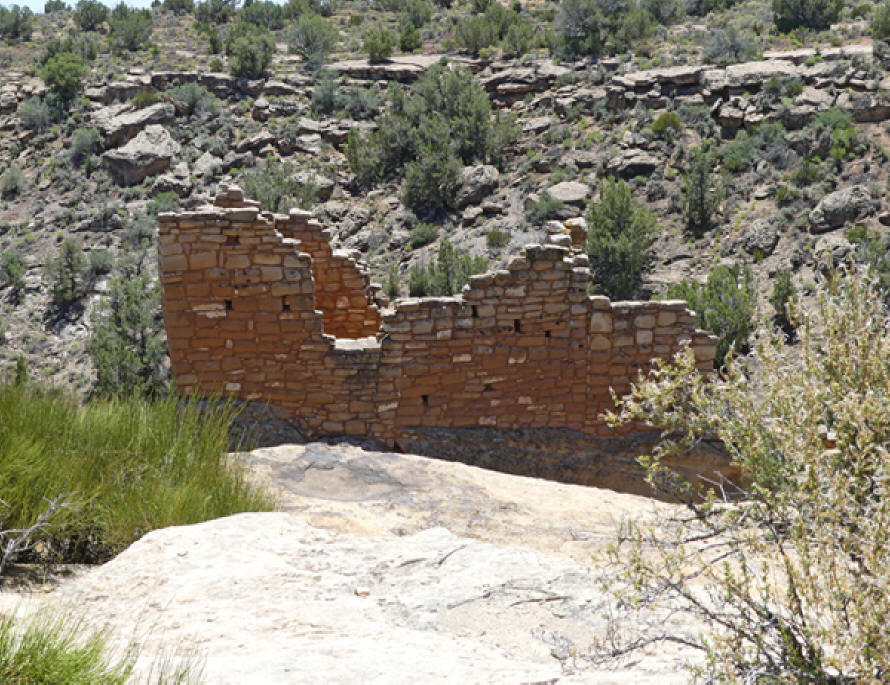 |
| Stronghold House |
Jim suggested a short 15 minute
hike to the canyon bottom to get a better view. Let
me just say, I probably should have listened and
worn those hated tennis shoes. Remember this if you
visit.
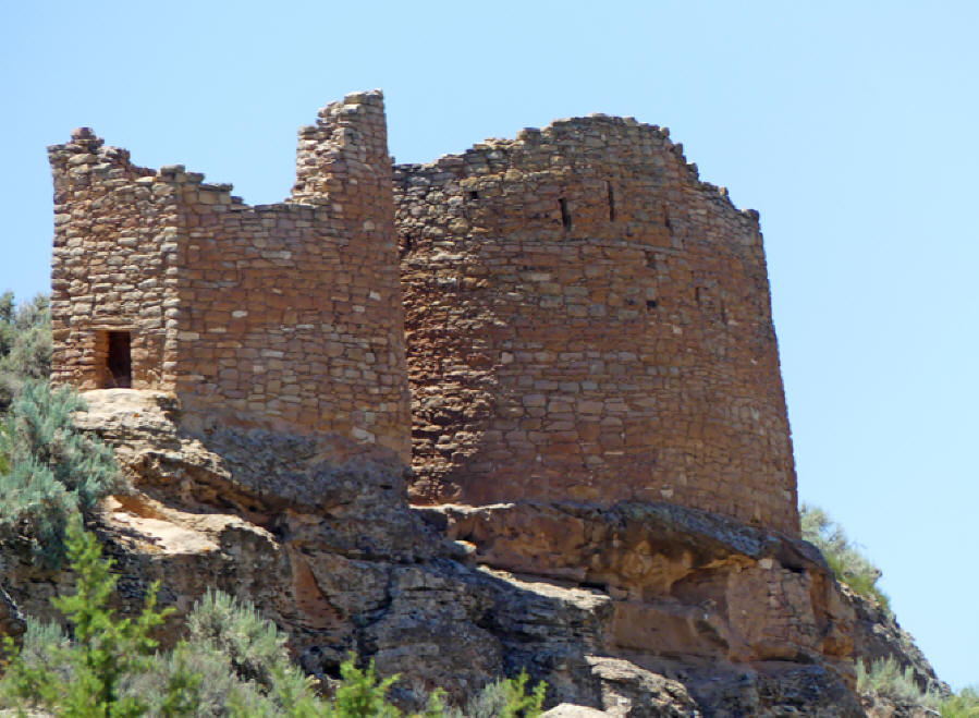 |
| Twin Towers |
From the bottom we did have a
completely different prospective. Twin Towers is a
unique pair of structures. One tower is oval, the
other horseshoe shaped. They almost touch one
another. Once they had sixteen rooms and are
considered one of the best constructed ruins in the
Southwest. Another eye catcher is Eroded Boulder
House. The boulder forms the roof and part of the
walls of the structure.
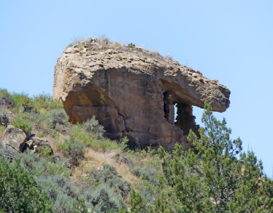 |
| Eroded Boulder House |
In just a few days visit, we
had traversed several centuries and I came back with
a more profound understanding of the human trail
from pre-history to modern civilization. This is a
trip I would advise for all. Just remember there are
some places that are difficult for babies or persons
with physical handicaps.
For More Info:
https://www.nps.gov/hove/index.htm
http://www.blm.gov/co/st/en/nm/canm.html
American Roads and
Global Highways has so many great articles you
may
want to search it for you favorite places or new
exciting destinations.
|


