|
Cumberland Gap National Historical Park
by
Thomas J. Straka
Photographs by
Patricia A. Straka
|
 |
|
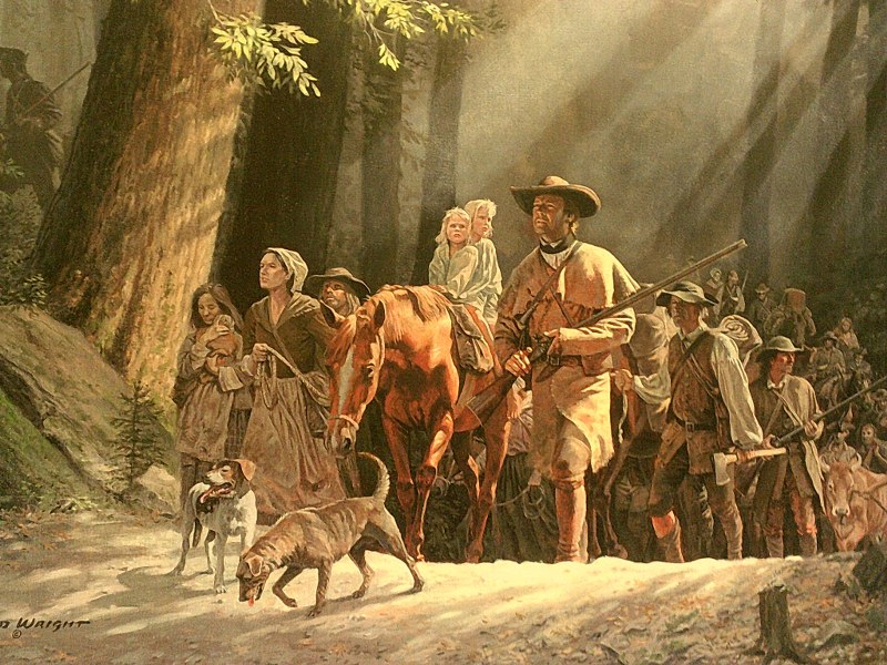
"Gateway to the West" by artist H. David Wright.
"Stand at Cumberland Gap and watch the procession of
civilization , marching single file—the buffalo
following the trail to the salt springs, the
Indians, the fur-trader and hunter, the cattleraiser,
the pioneer farmer—and the frontier has passed by."
Frederick Jackson Turner, 1893.
|
The Appalachian Mountains extend for nearly 1,500 miles from
Newfoundland in Canada to Central Alabama in the United States.
They are really a series of mountain ranges with an average
elevation of 3,000 feet, with some peaks exceeding 6,000 feet.
They were a natural barrier to westward expansion from
America's coastal plain to the boundless interior lowlands. Only
a few gaps existed in the mountain range. One feature of the
Appalachians is a series of interior lowland valleys that forms
a "trough" that runs from Canada to Alabama, called the Great
Appalachian Valley. That valley was a major transportation route
for Native Americans and later for colonial settlers. The Great
Wagon Road used this route to move settlers from Pennsylvania
south. The road
began in Philadelphia, crossed the Potomac River at Harpers
Ferry, and followed the Shenandoah Valley up to the town of Big
Lick (Roanoke today).
At Roanoke the road split, one route into the Carolinas
and ending in Augusta and the other route leading to the
Wilderness Road.
 |
|
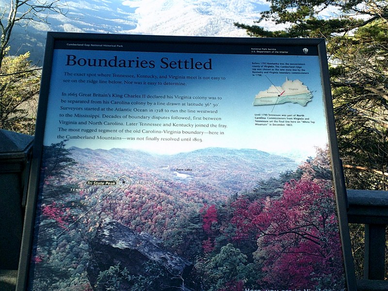
The boundary issue is quite interesting.
The exact
spot the three states come together Is accessible to
those who like to hike.
|
The Cumberland Gap was a timeworn wildlife and Native American
trail that allowed a great wave of westward expansion to open
the Ohio Valley. In
1750 Dr. Thomas Walker headed an expedition to stake out an
800,000 acre land grant in what is now Kentucky.
He is credited with bringing the gap to popular awareness
of settlers. But the land west of the mountains remained
wilderness. Daniel
Boone migrated south from Pennsylvania in 1750 with his family
(See Pennsylvania Trails in the Winter 2013 edition) along the
Great Wagon Road. Boone
hunted in present day Kentucky as early as 1769 and in 1773
attempted the first colonial settlement in the area with a party
of about 50 settlers, including his family.
The settlement failed. In 1775 Boone was commissioned to
blaze a road through the Cumberland Gap.
This became the Wilderness Road and established Boone's
reputation as a frontiersman and explorer.
 |
|
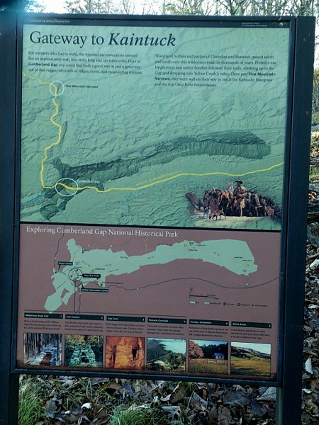
Gateway to Kaintuck.
|
The Wilderness Road started at Fort Chiswell in Virginia, looped
southward into Tennessee, and then northward into Kentucky.
It split with a southern route that eventually reached
today's Nashville and a northern route that eventually reached
the Falls of the Ohio (Louisville). Boone and 35 axmen cut the
road that really more like a trail or path. The Wilderness Road
was dangerous due to natural obstacles, Native American attacks,
and highwaymen. Settlers flooded into the Ohio valley and within
a decade after the Revolution, Kentucky became the fifteenth
state. The Wilderness Road remained the primary route to the
west until 1810. Notice there is a link to a map of the
Wilderness Road below.
 |
|
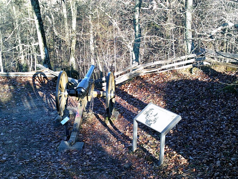
The park is full of Civil War sites, including
small forts and minor battle sites |
The Cumberland Gap has Civil War History.
It was considered strategic by both sides. No major
battles were fought there, but it did change hands several
times. An early attempt by the Confederates to gain control of
neutral Kentucky was thwarted (Battle of Camp Wildcat).
General Ulysses S. Grant referred to the Cumberland Gap
as the "Gibraltar of America."
Grant said, "With two brigades of the Army of the
Cumberland I could hold that pass against the army which
Napoleon led to Moscow."
The Confederates used the Gap for excursions into
Virginia. The park contains significant monuments to Civil War
action.
 |
|
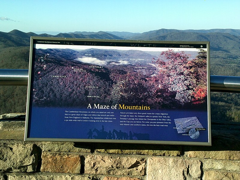
The view from Pinnacle Peak is spectacular, but can be
confusing. The map displays help.
You
are
looking at three
states and the Cumberland Gap simultaneously.
|
Pinnacle Peak Overlook offers a spectacular view of three
states. The exact spot Virginia, Tennessee, and North Carolina
join is clearly visible and very near the Gap itself.
You can drive almost to the top.
Civil War fortifications are still on the mountain and
even a few cannons. There are lots of other things to see on the
70 miles of hiking trails: Fern Lake, one of the many valley
lakes dominated by mountains; Southern Appalachian Mountain
habitat, including ferns and spring blooms of the trillium; and
beautiful White Rocks at the eastern tip of the park atop
Cumberland Mountain.
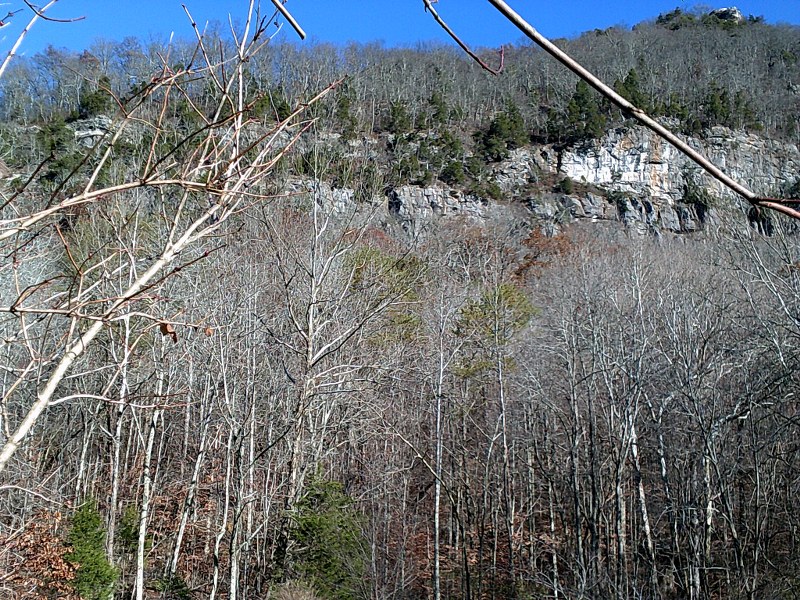 |
White Rock Cliffs. When viewed from the
Wilderness Road these cliffs cast a white glow due to
white
quartz pebbles in the sandstone. The first
hunters through the gap made the White Rocks landmark |
As you'd expect the park has caves.
Starlight Cave can be reached only by trail. Gap Cave
(formerly called Cudjo's Cave) is open to ranger-led tours.
It offers opportunities to see cave crickets, bats,
salamanders, and a glorious variety of cave formations.
A second guided tour is the Hensley Settlement, an early
twentieth century homestead with original buildings and
farmland. The settlement is located on a plateau on top of Brush
Mountain almost 1,000 feet higher than Pinnacle Peak. It
includes fence-lined lands, a blacksmith's shop, springhouse,
and one-room schoolhouse.
The settlement was established in 1904 and occupied until
1951. This tour can
last up to four hours.
 |
|
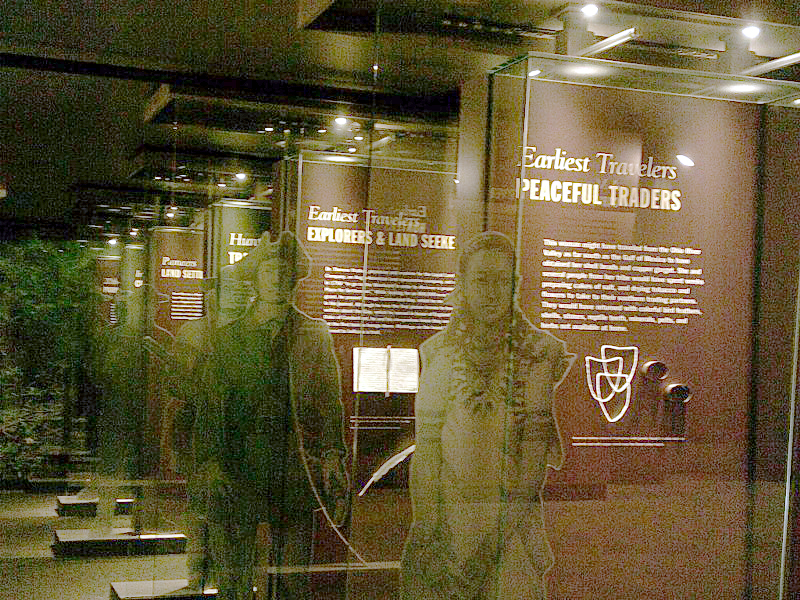
The historical park has an attractive visitor's center
that includes many historical themes |
There is also a tunnel for the kids.
The Cumberland Gap Tunnel was built in the 1990s.
The four-lane road passes under the mountain and is
nearly a mile long.
The old Gap road was considered dangerous and was claiming about
five lives a year.
The old road bed was totally removed and the original trail is
now in its place.
 |
|
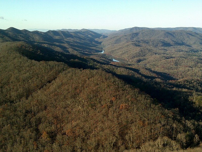
Cumberland Gap in early winter. |
Cumberland Gap National Historical Park offers something for
everyone. Fantastic
vistas; spectacular hiking trails; history from exploration, to
civil wars, to federal highways; caves and rock formations for
the geologists; and even an early twentieth century farmstead.
No location map is needed for this article. Just look for the
point
that joins the three states. If you are on Interstate 75, 40, or
81 in the Appalachian Mountains, and are interested in a more
"natural" shortcut, consider a route through the Cumberland Gap.
 |
|
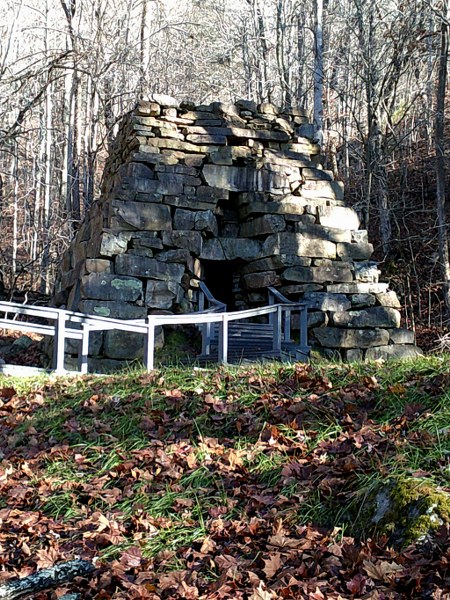
Iron furnace at the park. One of many interesting
side trips.
|
Authors:
Tom Straka is a forestry professor at Clemson University in
South Carolina. His wife, Pat, is a consulting forester. Both
have a keen interest in history.
For more information:
Cumberland Gap National Historical Park (National Park Service)
http://www.nps.gov/cuga/index.htm
Highway History of Wilderness Road (Federal Highway
Administration)
http://www.fhwa.dot.gov/infrastructure/back0204.cfm
History of Cumberland Gap National Historical Park
http://www.nps.gov/history/history/online_books/cuga/luckett/index.htm
Cumberland Gap National Historical Park Maps:
Park Map:
http://www.nps.gov/cuga/planyourvisit/upload/CUGAmap1-3.pdf
Cumberland Gap Area Map:
http://www.nps.gov/cuga/planyourvisit/upload/CUGAmap2.pdf
Route of the Wilderness Road:
http://www.nps.gov/cuga/planyourvisit/loader.cfm?csModule=security/getfile&PageID=217901
|